Have you ever imagined flying over Mount Everest, walking through New York City streets, or exploring the pyramids of Giza — all without leaving your room? With Google Earth, all of this is possible and more.
In 2025, Google Earth has transformed into a powerful platform for virtual exploration, education, and professional use. This detailed guide will show you everything you need to know about using Google Earth across web, desktop, and mobile.
🌐 What is Google Earth?
Google Earth is a 3D interactive globe created by Google, using high-resolution satellite imagery, street view, and geographic information system (GIS) data. It allows users to virtually explore any place on Earth — and even beyond, including the Moon and Mars.
Google Earth is available in the following formats:
- 🌍 Web Version – No installation required
- 🖥️ Google Earth Pro – Advanced features for PC and Mac
- 📱 Mobile App – For Android and iOS devices
🔥 New Features in Google Earth 2025
In 2025, Google Earth has introduced game-changing features:
- 📸 Updated satellite and 3D images for clearer, more recent views
- 🎥 Improved Timelapse Tool for visualizing changes across decades
- 🧠 AI-Powered Landmark Descriptions with instant facts
- 🕶️ AR & VR Mode for an immersive 360° exploration
- ✍️ Story Projects with Multimedia for students and storytellers
🛠️ How to Use Google Earth in 2025: Step-by-Step
🔎 1. Search Any Place on Earth
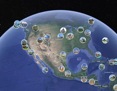
Just type in the name of a place, address, or coordinates in the search bar and jump directly to it.
🧭 2. Navigate in 3D
Enable 3D mode to fly around landmarks, cities, and natural wonders in full 3D with tilt and rotate controls.
🚶 3. Street View Mode
Drag and drop the yellow Pegman icon to enter Street View and walk virtually through roads and sites.
📏 4. Measure Anything
Use the ruler tool to measure distances between locations or calculate area sizes for land or property.
🎬 5. Create Custom Projects
Add custom pins, images, and text to tell stories or plan travel. Save and share with others easily.
🧑🏫 Google Earth in Education
Thousands of schools now use Google Earth to bring geography, history, and science to life. Here’s how teachers and students benefit:
- 🌍 Virtual field trips to national parks and historical sites
- 🛰️ Real-time weather and climate data visualization
- 🕰️ Historical imagery for research and comparison
- ✏️ Assignments using Google Earth Voyager
Voyager includes ready-made journeys on topics like oceans, space, wildlife, and culture — all aligned with educational standards.
🏗️ Google Earth Pro: For Professionals
Google Earth Pro is a free downloadable version ideal for professionals such as:
- Urban Planners
- Architects
- Environmentalists
- Real Estate Agents
Top Google Earth Pro Features:
- Import GIS and shapefiles
- Export high-resolution images for reports
- Record virtual flyover tours
- Historical views for land-use comparison
Download it from: https://www.google.com/earth/versions/#earth-pro
📱 Use Google Earth on Mobile
Whether you’re on the move or lying in bed, the Google Earth app offers:
- 3D Maps
- Street View
- Location Search
- Voyager Content
- Fun quizzes and facts
🕒 Explore the Past with Timelapse
One of the most powerful features of Google Earth is Timelapse, allowing you to view environmental and urban changes over time.
Examples:
- Deforestation in Brazil
- Melting of Arctic ice
- Expansion of major cities like Dubai
This is a powerful tool for journalists, scientists, and educators.
🌌 Google Earth Beyond Earth: Moon & Mars
Tap the planet icon and switch from Earth to:
- 🌕 The Moon – Explore Apollo landing sites
- 🔴 Mars – View canyons, craters, and data from NASA missions
A must-have for space enthusiasts and students!
🔐 Is Google Earth Safe?
Yes, Google Earth is 100% safe to use. It doesn’t store or share personal information unless you choose to upload or publish projects. All data is encrypted, and the app is regularly updated for security.